


Espace naturel sensible

Lacaze
User

Length
7.4 km

Max alt
622 m

Uphill gradient
97 m
Km-Effort
8.6 km

Min alt
574 m

Downhill gradient
96 m
Boucle
Yes
Creation date :
2014-12-10 00:00:00.0
Updated on :
2014-12-10 00:00:00.0
1h54
Difficulty : Unknown

FREE GPS app for hiking
 SityTrail
IGN / Geographical institutes
SityTrail Plus
The world is yours!
About
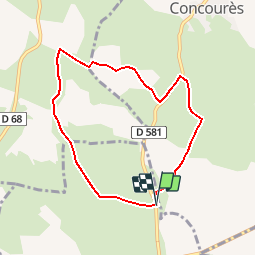
Trail Walking of 7.4 km to be discovered at Occitania, Aveyron, La Loubière. This trail is proposed by Lacaze.
Description
Départ parking au panneau de l'espace naturel route de Concoures 400m après le carrefour en venant de Rodez
Positioning
Country:
France
Region :
Occitania
Department/Province :
Aveyron
Municipality :
La Loubière
Location:
Unknown
Start:(Dec)
Start:(UTM)
471590 ; 4918690 (31T) N.
Comments